
We’ve recently launched the latest version of Insight (2.6.4), this is now live for all Insight customers. We’ve been busy adding several exciting new features and enhancements in this release, here’s a rundown on what’s new.
What’s New
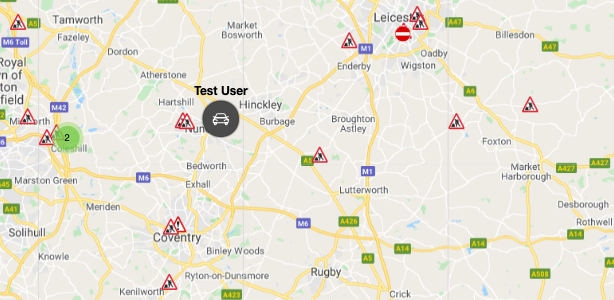
Custom info card – Add vehicle registration or driver’s name to map markers
We’ve added the ability to configure an extra line of information to the map marker itself (when vehicles are not clustered). This is administered in ‘company settings’ via cards interface.
Users can optionally choose to see one of:
- Vehicle Reg
- Driver Name
This information is turned off as default and changes made will affect the entire organisation.
This allows system users to quickly identify their vehicles’ status and locations without having to interact with the portal. This is especially helpful for customers that wish to view the map data on a larger screen in their workspace.
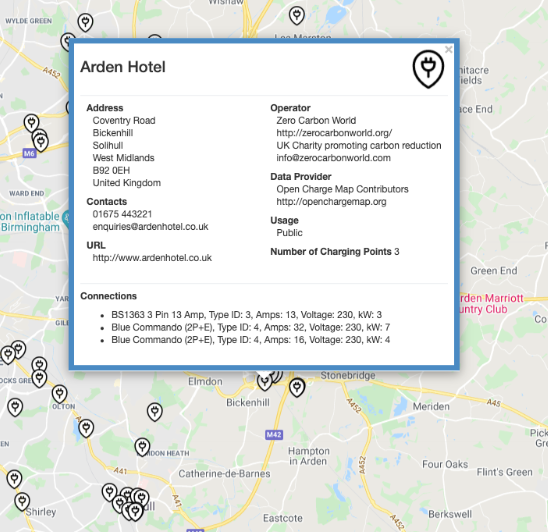
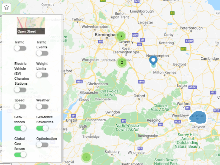
Electric vehicle charge post mapping layer
Charge point information and markers have been added as a configurable mapping layer. This allows users to locate EV charge points and then direct their drivers using the most efficient routes.
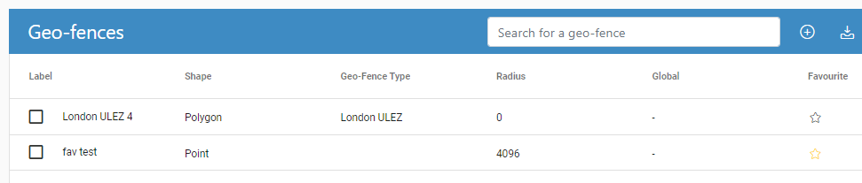
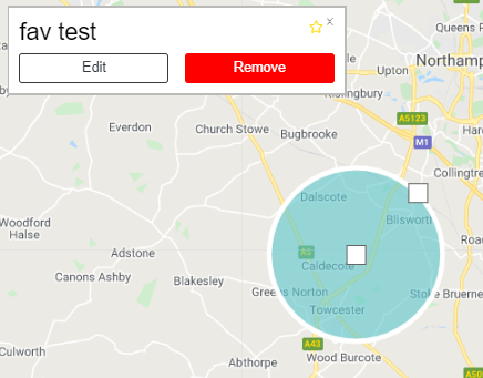
Geo-fence favourites
We’ve added the ability to select ‘favourite’ preferences against individual geo-fences within the administration menu. Favouriting a geo-fence enables its visibility and zoom markers on the map. Geofences that are not favourited will not be visible. This feature improvement allows users to load all of their active geo-fences and then select those that need to be visible, this is especially helpful when there are a large number of geofences required for an organisation.
This can also be selected within the geo-fence edit options on the map:
Geofence overstay/loiter event
This is a new feature that allows users to be alerted when vehicles exceed a geo-fence’s maximum stay duration. The maximum stay duration for a geofence can be added at geofence creation or updated retrospectively.
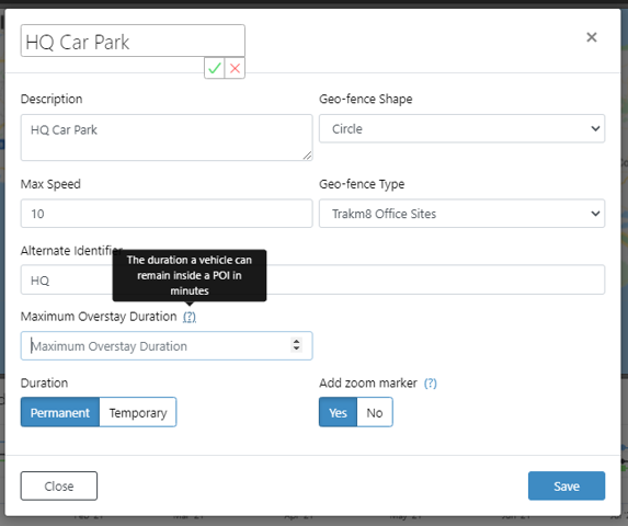
The maximum overstay duration field allows users to enter the total number of minutes a vehicle is permitted to stay within the geofence. This ‘maximum duration in geofence’ field can also be used to trigger alerts and cases. This allows users to set bespoke characteristics for geofence idling alerts and identify true exceptions based on this.
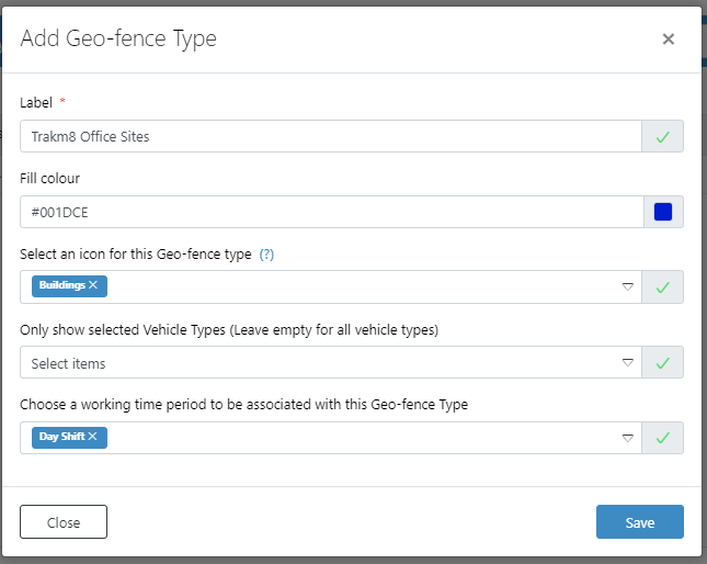
Geo-fence ‘working hours’ filter
Geo-fence/POI characteristics have been improved whereby a user can now associate a working time period with a geo-fence type category. This means that the alerting for geofence entry and exit events can be filtered in order to only show users valid events based on their preference, i.e. only show alerts for events that are outside of the set working hours.
Traffic events – show details and affected vehicles
Improved traffic events and information as an additional mapping layer.
When a user has this layer enabled, they can view and select traffic events which then gives them a description, a timeframe for the event to be cleared and a list of vehicles that may be affected by this.
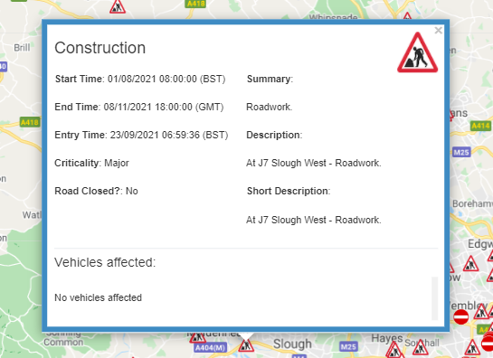
This will inform users of real-time traffic data which may impact their operating schedule, users can communicate this information with their customers as well as notifying drivers of potential delays and route alternatives.
User mapping preferences saved
Updated map settings at user level. When a user selects the layers that they wish to see displayed on the map, Insight will now persist these settings and set them as the default for the user going forwards.
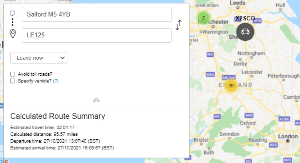
Find nearest vehicle enhancement and calculate routes
Improved mapping features that allow users to calculate routes and journey duration between two points on a map. This is in addition to the existing ‘find nearest vehicle’ feature.
This feature is seen when a user right clicks on the map widget and selects ‘calculate route to here’. An overlay box will load the selected map location and allow users to enter a start position via postcode.
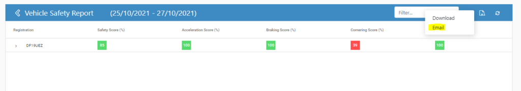
Email reports to another user
Added ability to email a report to another system user. When a report has loaded, there is now an additional option to export the data via email from a drop-down list of users within the organisation.
This allows users to share data through the system without having to leave the portal, improving workflow and efficiency.
Mobile login with Driver PIN
New login authorisation method for Insight mobile app users. When a user first logs in to the Insight mobile app they will be asked to select an authorisation method to access the system with which now includes ‘Driver Pin’.
The driver will require a bespoke pin to access the app rather than a username and password, this will provide easier and quicker access for users in the field.